|
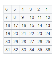
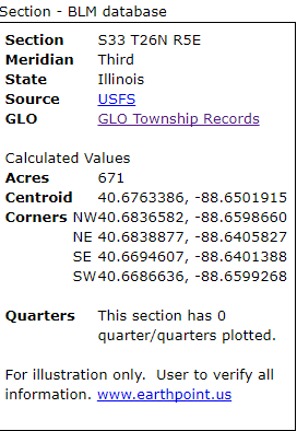
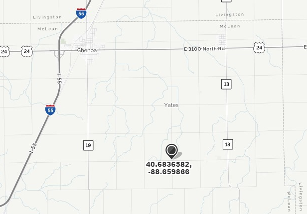
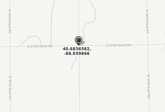
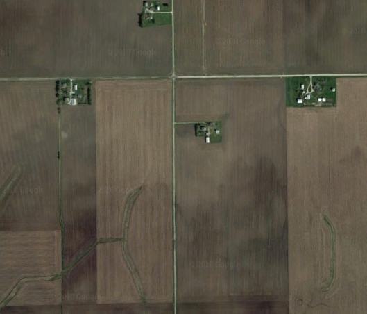
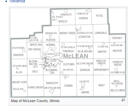
I had a problem recently trying to find where some of my ancestor’s property was in McLean County, Illinois. I have some 1850s and 1860s deeds describing his property as being in sections 32 and 33 of Township 26 Range 5. I wanted to see where that was on a map. Unfortunately when I look at McLean County information now, all the townships seem to have names, not numbers and I can’t tell where Township 26 lies in the county and in relation to other properties my ancestor owned. I went to the BLM website (https://glorecords.blm.gov/) and entered the information for my property. Unfortunately, for some reason I can’t quite figure out, when I clicked on the “Map” box to see the property, I got a message “Due to data limitations, we could not map the township of this land description. No township is available.” Well, that’s not very helpful! In this area, townships were generally six miles by six miles, a square divided into a 6 x 6 grid of smaller squares. Each of these smaller squares is a section. The section numbering begins at the upper right corner of the township and looks like this: I already knew that part. What I couldn’t figure out was where a particular numbered township was located within McLean County. But by googling “how to find section township range” I found Earthpoint - http://www.earthpoint.us/ There I can put in the Principal Meridian, township, range and section, and Earthpoint gives me GPS coordinates for the center of the section as well as its four corners. I know that my ancestor’s properties were in the NE corner of Section 32 and the NW corner of section 33, adjacent sections. According to Earthpoint, my ancestor’s common corner is at 40.6836582, -88.6598660. Now I can copy and paste those GPS coordinates into MapQuest. I’ve always used MapQuest with a street address to find the property, but it’s nice to know MQ can locate based on GPS coordinates as well. When I drop those coordinates into MapQuest I get a map: I have drawn a box around the 36 sections of what was once Township 26. I can see it lies in the northeast corner of McLean County and is bordered on two sides by Livingston County. Zooming in I can see the road names I can look at a satellite view on MapQuest or drop the same GPS coordinates into GoogleEarth to see a bird’s eye view of what the property looks like now. That creek running through his property on the map shows up as a green swath against the brown field. Looking on Wikipedia for McLean County, IL, I finally know that Township 26 is now called Yates Township: It took a few steps to get there, but know I know just where my ancestor’s property was. I’ll do the same thing to track his path of property ownership across the area from Tazewell to McLean and then on into Champaign counties. I’m looking forward to visit the area in the Fall. If you run into a problem with the mapping feature on the BLM website, I hope you find this post helpful.
3 Comments
Ginny
2/6/2018 02:48:16 pm
Nice post, Mary. But isn't Yates township in the northeast corner of McLean County?
Reply
Mary Kircher Roddy
2/6/2018 02:59:16 pm
Oh, you're right, Ginny. Sharp eyes. Thanks for finding my error. I have corrected it in the blog post.
Reply
2/17/2018 12:51:56 pm
Great job figuring that out! Thanks for sharing!
Reply
Your comment will be posted after it is approved.
Leave a Reply. |
AuthorMary Kircher Roddy is a genealogist, writer and lecturer, always looking for the story. Her blog is a combination of the stories she has found and the tools she used to find them. Archives
April 2021
Categories
All
|

